Monday, November 9, 2026
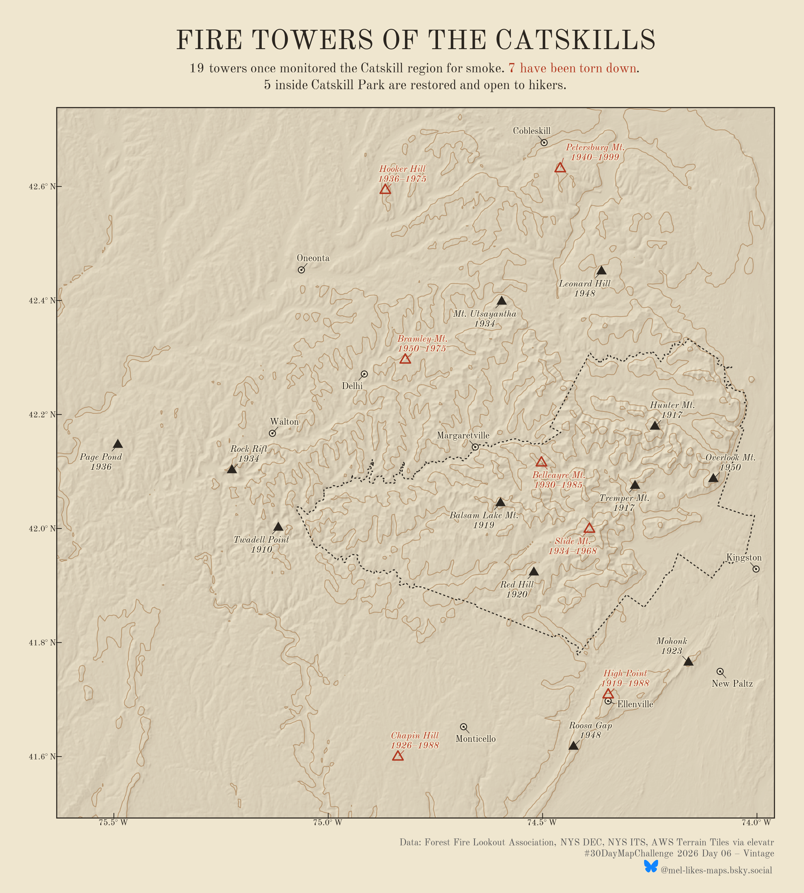
#30DayMapChallenge Day 06 · Vintage Continuing with the data from day 5 - Catskill Fire Towers. At the program’s peak, 19 towers monitored the area for forest fires. Seven have been torn down, and five have been restored and are open to hikers. Styled like a 1930s USGS topo sheet in #rstats.